Archive for January, 2010
Mexico Lindo

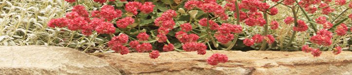
Manos Arriba!
Here are a few photos of our trip to Baja. We just got back, and we’re still catching up on everything. Apparently, there has been a bit of rain while we were gone. Our plants are happy, but no one else seems to have enjoyed it.
I can’t say I missed it. Baja was great, one of the best trips we’ve taken and definitely our best bicycle tour. We travelled about half the peninsula, from San Ignacio to San Jose del Cabo, cycling about 300 miles and busing through the boring section south of Ciudad Constitucion and the busy section near Cabo; the 150 miles of riding along the Sea of Cortez from Santa Rosalia to south of Lareto was perfect in just about every way. And, the sign of a great trip, at the end we felt ready to come back home but also determined to go back to Baja in the future. We spent a lot of time checking out the Baja plants, so I should have some posts about the desert soon.

Volcan las Tres Virgenes
It’s a big desert down there, so some of the small-format photos don’t do it justice. As always, you can see them at a bigger size if you click on them.

Cemetary South of Santa Rosalia

Playa Ligui and Isla Danzante

Roadside Tire Repair

Playa Escondida, Bahia Concepcion
Te Hapu, New Zealand

Kilroy was Here
Happy New Year everyone. For the first post of the year, something from the days before BuenoLuna and DryStoneGarden: Ryan’s Bush Track from the winter when Anita and I did some bicycle touring and WWOOFing on the South Island in New Zealand.
Another crew leader in the trail building scene just got back from New Zealand and sent me photos of Te Hapu, a one thousand acre sheep and cattle farm along the coast in the uppermost northern corner of the South island, New Zealand, on the west coast just below Farewell Spit. Anita and I spent almost a month there, during which time I made a trail through a section of native rainforest and did a reroute on another trail that goes to a waterfall. The Te Hapu website has a map of the property viewable as a pdf. Ryan’s Bush Track is near the northern (right) property boundary. It gives a sense of the size of the property to see my tiny little track and know that it is a kilometer long. It’s an amazing place and Sandra and Ken, the owners, were great hosts when we stayed there. Pretty funny that they named the trail and put the sign up. I guess people will know who to blame for the muddy spots.

The Track

Start of the Track through Gorse and Ferns
I got to know prickly-leaved gorse, as well as the native plants, while I was playing around in the bush making the trail. Gorse is one of the big problem weeds of New Zealand and the target of a lot of eradication efforts, but it also gets some begrudging appreciation as a nursery plant for native trees, getting tall and leggy in its old age and providing shade for native rainforest trees to recolonize and then eventually shade it out. At Te Hapu it seems to have acted as a barrier to keep out the cattle. From the outside of the gorse, there was little sign of the rainforest hiding inside; I could just see gorse and the tops of a few trees rising out of it.

I remember three kinds of tree ferns at Te Hapu. I think the one in the photo is Dicksonia squarrosa, a relative of the Tasmanian tree fern that is common in Bay Area gardens. The most beautiful one was the black tree fern, Cyathea medullaris, which I’ve never seen available in a nursery.

Hapu Beach
Outside of the rainforest, the scenery reminded me somewhat of the central coast of California, though California doesn’t have this type of limestone outcroppings. Some of the rocks are still topped with rainforest where the sheep and cattle can’t climb up to it. I had climbing shoes with me to explore the rock a bit, and it was a strange experience to start on turf and climb up into rainforest so dense that it was difficult to move through.

Gilberts Beach
It’s the only private property I’ve ever known where the owners had multiple beaches to pick from — one for swimming in calm water, one for playing in the waves and body-surfing, one for tidepooling and abalone hunting, and others for just watching waves crash violently against the rocky shoreline. They rent guest cottages to travelers, something that’s common in New Zealand where farms often have nicer scenery than the public lands. In fact, Te Hapu has a national park bordering it, but the park doesn’t have any trails or access.
y


My thanks to On Lee Lau for the photos. Anita and I were traveling without a camera when we stayed at Te Hapu, so it was great to see photos of the place; they make me want to go back. More photos can be seen at the Te Hapu website. Really, though, the place needs to be seen in person to be truly appreciated, and there’s more to it than I can cover in a single blog post (first place I watched dogs mustering sheep, there are caves on the property, and google turns up a recent photo of a blue whale carcass on the property). Anyone who is ever going to be in that part of the South Island should try to make a visit.
On a somewhat related note: Tomorrow, Anita and I leave for Baja to bicycle tour around the southern section between San Ignacio and Cabo. A couple of posts should happen while I’m gone, but I won’t be responding to comments for a while.
You are currently browsing the DryStoneGarden blog archives for January, 2010.
Categories
- bay area (7)
- miscellaneous (13)
- plants (69)
- california natives (34)
- bulbs (2)
- wildflowers (10)
- edibles (3)
- trees (14)
- california natives (34)
- private gardens (34)
- lawn to garden (12)
- public gardens (49)
- tilden (9)
- UC Berkeley (3)
- sculpture (32)
- sketchbook (39)
- stone (74)
- sustainability (4)
- trails (13)
- various critters (5)
- wildlands (15)
